Extreme Weather: Winter Storm Orlena Hits Chicago, Moves Towards New York City

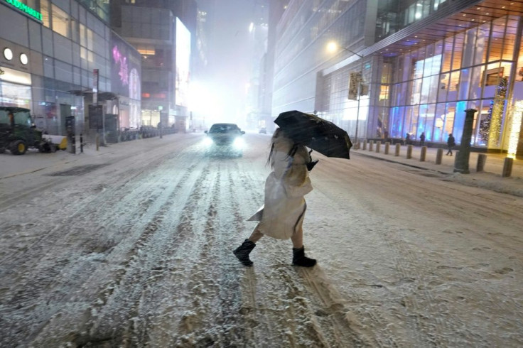
The Midwest and the Northeast areas of the United States are expected to be hit by a blanket of snow as winter storm Orlena sweeps across the country after hitting parts of California last week. The brutal conditions are expected to arrive Sunday on the East Coast in the form of a nor’easter.
The National Weather Service reported that parts of the greater Chicago area saw between 6 and 10 inches of snow overnight and into Sunday morning.
[10:40 AM 1/31/2021] Here's a general overview of snowfall amounts from reports we've received from cooperative observers, broadcast media, social media, and others. Snow will continue today, so this map will be updated into tomorrow as additional reports come in! #ILwx #INwx pic.twitter.com/FVdWiJF5JF
— NWS Chicago (@NWSChicago) January 31, 2021
Here is the latest on the major nor'easter expected through Tuesday. Widespread snowfall accumulations of 8-12 inches, including pockets of 18 inches, are likely in the Northeast. Additional freezing rain is likely in NC, VA, and WV. pic.twitter.com/XIpFhJLAlf
— NWS Weather Prediction Center (@NWSWPC) January 31, 2021
Snow is expected to continue falling through Sunday in the southern Great Lakes and pick up in the mid-Atlantic. It is expected to slow down once it hits the upper Midwest.
The snow fell early Sunday in Washington, D.C., and is making its way north.
The New York City tri-state area is expected to see snow starting Sunday night. Parts of New England may not be affected by the storm conditions due to the dry air in the area.
The peak of the storm is expected to hit Monday. The areas that will experience the heaviest snowfall will depend on the track of the low pressure formed in the Northeast.
Strong winds could mean parts of New York's metro area could face near-blizzard conditions. Forecasts call for 6-to-12 inches of snow in the Northeast.
The National Weather Service issued a Winter Storm Warning for a majority of the tri-state area for late Sunday night through Monday night.
A major nor'easter will be impacting the Eastern US through Tuesday. Here are the latest snowfall, wind gust, and coastal flooding forecasts. Near blizzard conditions are possible along the coast Monday-Monday night where the strongest winds are expected. pic.twitter.com/mFSLe9DG0x
— NWS Eastern Region (@NWSEastern) January 31, 2021
Snowfall will begin Sunday around 6 or 7 p.m. ET and accumulate one to three inches overnight. Winds of 40 to 50 mph are expected Monday along with the snowfall, causing low visibility and slippery road conditions.
"I am urging all New Yorkers to ... begin preparing their households for this latest round of winter weather," said New York Gov. Andrew Cuomo.
The storm is expected to taper off by Tuesday.
Our Sunday plans? Covering #Orlena! We have teams across the Northeast bringing you the latest on this storm. @mikeseidel in Chicago ⬇️ pic.twitter.com/LID5NCK2Ih
— The Weather Channel (@weatherchannel) January 31, 2021
© Copyright IBTimes 2026. All rights reserved.
- MOST READ