

Snowstorm Weather Today: 50 Million Affected By Snow, Rain As Flights Get Cancelled
Post-Thanksgiving air and road travel for millions of travelers has become more nightmarish than usual due to unrelenting snowstorms and rain pummeling the Northeastern United States after tearing through the Upper Midwest. More than 50 million Americans, a sixth of the total population of 330 million, are under some kind of winter weather alert, estimates the National Weather Service (NWS).
Air travel was already exasperating before Sunday, the busiest air travel day in the U.S., and has now moved beyond that into horrifying. By Sunday evening, nearly 7,300 flights were delayed within, into or out of the United States. Another 890 were canceled as of writing, according to FlightAware.com that provides live flight tracking data.
American, Delta and other airlines are issuing travel waivers for travelers that want to cancel or change their plans. These hair-pulling delays and disruptions are expected to last into Monday.
New York City is contending with heavy and cold rains Sunday evening, and this misery will turn into a downpour of ice and snow Monday morning. The NWS said the city can expect three to five inches of snow by Monday evening. New York will see up to two inches of snowfall an hour Sunday and Monday, said NWS.
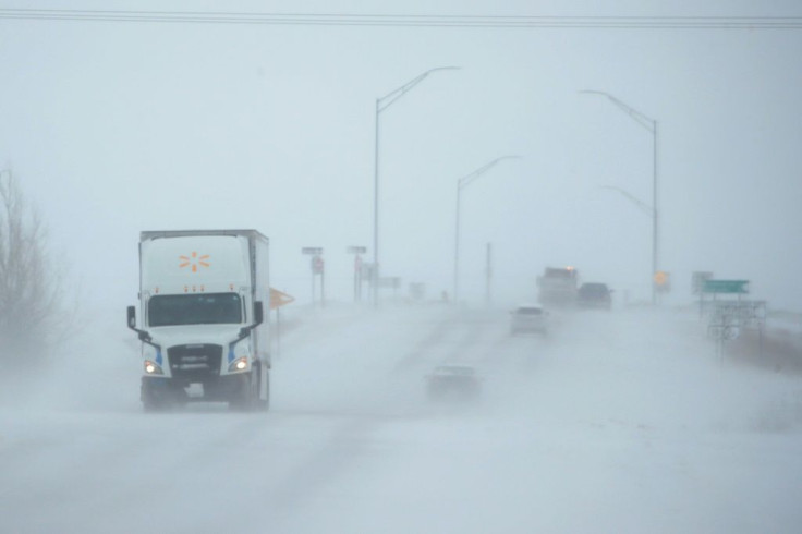
This hazardous snowfall will make for dangerous roads as the snow thickens. Downed trees and power lines will add to the dangers faced by motorists as they travel home. New York State Gov. Andrew Cuomo has placed the National Guard on alert for snow emergencies.
I am placing National Guard personnel on standby and activating our emergency command center to ensure we are able to respond quickly and effectively to this storm.
— Archive: Governor Andrew Cuomo (@NYGovCuomo) December 1, 2019
I urge New Yorkers to exercise caution in the face of snow, black ice, and other hazardous conditions.
The Great Lakes region will see blizzard-like conditions Sunday. NWS forecasts up to 12 inches of snow might hit the Dakotas to Michigan. On Tuesday, parts of the Northeast will see up to a foot of snow.
And there's the rain. Areas to be awash in rain will stretch from coastal areas in the Northeast to farther south where it will come with thunderstorms and strong wind gusts.
"A cold front will be positioned from central Ohio, arcing eastward near the Appalachians, then south-southwestward into the Florida Panhandle," said the NWS. Thunderstorms are possible along this arc but the system should leave the Southeast by Sunday night.
Massachusetts' Emergency Management Agency issued an "awareness statement" warning of eight to 12 inches of over most of the state and up to 17 inches on the eastern slopes of the Berkshires. Wind gusts are predicted at 45 mph along the coast, with Cape Ann and outer Cape Cod being the worst hit.
Weather conditions are about as bad out West. A West Coast storm bearing down on Seattle and extending to the south of Los Angeles is poised to dump feet of snow into these areas, said forecasters. They said tire chains will be a must when navigating roads in mountainous regions. Forecasters also predict very dangerous white-out conditions in some areas of California.
"Travel is HIGHLY DISCOURAGED after 10 a.m. (Sunday) for the Coastal Range/Shasta County," warned the NWS Sacramento office.

© Copyright IBTimes 2025. All rights reserved.
- MOST POPULAR IN National


