Tornado Watch Texas: San Antonio, Other Cities See Hailstorm, Rainfall, Power Outages

Multiple thunderstorms accompanied by tornadoes are expected to pass over the central part of Texas through Wednesday night, continuing into early Thursday morning.
The National Weather Service issued a tornado watch for south-central Texas on Wednesday afternoon, which was set to expire 2 a.m. CST Thursday (3 a.m. EST).
“Storms will continue to increase this evening, initially across the Edwards Plateau. Damaging winds and some severe hail will be possible, but a few tornadoes will also be possible, especially as storms encounter richer moisture and stronger low-level shear toward the Hill County/I-35 general vicinity later this evening into the overnight,” the watch added.
The area under the watch extended 95 statute miles east and west of a line from 60 miles west-northwest of Austin, Texas, to 45 miles south of Hondo, Texas. Among the threats to look out for in the period of the tornado watch were multiple tornadoes, potentially damaging wind gusts to 70 mph and isolated large hail events to one inch in diameter.
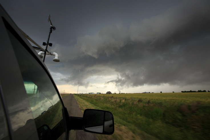
As the storm clouds moved east toward San Antonio, social media was filled up with pictures of golf ball-sized hailstones falling in many parts of the state:
That's some Texas-sized hail in Camp Wood! #kens5eyewitness #BlueBellForScale pic.twitter.com/Y6yg19hsAO
— KENS 5 (@KENS5) December 27, 2018
That hail in Brackettville is no joke! #kens5eyewitness Lilianna V. Ortiz sent us this photo of golf ball-sized hail. 🏌 Look out! pic.twitter.com/C1wOYz8dlX
— KENS 5 (@KENS5) December 27, 2018
“The storms have the potential to produce the full spectrum of severe weather into Thursday, ranging from damaging wind gusts and flash flooding to hail, frequent lightning strikes and a few tornadoes," AccuWeather Senior Meteorologist Alex Sosnowski said.
Textbook SHELF CLOUD closing in on Abilene, TX! This will bring string straight-line winds, blowing dust along I20 corridor between Abilene and DFW@breakingweather @accuweather #txwx #tornadowatch pic.twitter.com/VaZZ9bkBJI
— Reed Timmer (@ReedTimmerAccu) December 26, 2018
Only a Texas sized storm rolling through tonight pic.twitter.com/MTMztww1lQ
— Taylor Baird (@taylordbaird) December 27, 2018
We boarded the plane @ 2:45pm.
— Grecia S. Lopez (@greciaslopez_) December 27, 2018
It’s about to 4 hours. FOUR.. of waiting on the plane waiting for the thunder storm to pass.⛈
#DFWTraffic #DFW #Texas #Storm @DFWscanner @DFWAirport pic.twitter.com/V9WJkm7MM6
Textbook SHELF CLOUD closing in on Abilene, TX! This will bring string straight-line winds, blowing dust along I20 corridor between Abilene and DFW@breakingweather @accuweather #txwx #tornadowatch pic.twitter.com/VaZZ9bkBJI
— Reed Timmer (@ReedTimmerAccu) December 26, 2018
Brief heavy rainfall, up to two inches, was expected in Austin following a number of thunderstorms passing through the area between Wednesday noon and early Thursday morning. Humid southeast winds of 15 mph with gusts as strong as 20 mph was expected to raise the temperature in the region to a warm 68 degree Fahrenheit. Residents would experience a drop in the temperature, with clear skies only after the storms have passed through Austin, the Statesman reported.
One of the storms – Winter Storm Eboni – that passed through Austin on Wednesday caused turbulence and resultant damages to a plane which ultimately managed to land safely at Austin-Bergstrom International Airport. Austin-Travis County Emergency Medical Services were called at the scene and two of the passengers were rushed to a nearby hospital while one of them were treated at the scene.
Storm damages were reported in Wichita Falls, with photos of fallen trees on roads seen on social media. Widespread power outages were also reported with over 55,000 customers without electricity at 6:50 p.m. CST Wednesday (7:50 p.m. EST). According to Power Outage, as of 10:30 p.m. EST, nearly 37,500 Texan customers were without power.
Wind damage and power outages have been reported around Wichita Falls, Texas, after severe thunderstorms rolled through earlier this evening (Photos/@rguthrie0209): https://t.co/Pk8iCmmNFX pic.twitter.com/FCrh7YcTXd
— Breaking Weather by AccuWeather (@breakingweather) December 27, 2018
There were chances of moderate flooding in Dallas, with water in the White Rock Creek going above 15 feet on Wednesday and continuing to rise overnight. A First Responder Bowl in Dallas was canceled due to bad weather 10 minutes after the teams - the Boise State Broncos and the Boston College Eagles – started playing.
@FRBowl #WeAreBC pic.twitter.com/VxqZ9CnXk2
— Randy Luck (@Randy_Luck) December 26, 2018
"In my career, this is a first," Boston College Eagles head coach Steve Addazio said, Weather reported. "I don't second-guess anything about it. The decision was made for the right reasons and that's the welfare of both teams' players."
A message on the Storm Prediction Center read: “Parts of the U.S. Government are closed. However, because the information this site provides is necessary to protect life and property, it will be updated and maintained during the Federal Government shutdown.”
© Copyright IBTimes 2026. All rights reserved.
- MOST READ