

Extreme Weather 2019: Could Two Tropical Weather Patterns Indicate The Beginning of Hurricane Season?
Weather activity near the eastern coast of Florida, called "Invest 98L" by meteorologists, could result in heavy winds and rains in the southeastern U.S., with a high possibility of a tropical storm this week.
Accuweather meteorologist Dan Pydynowski said that "by Saturday night or Sunday, the center of 98L will move northeastward off the east coast of Florida Peninsula. However, localized downpours can still impact the eastern parts of the state."
"Once this happens 98L would move into an area conducive for a tropical depression or storm as it will be centered in an area with warm water and relatively low vertical wind shear," he added. Wind shear describes the difference in wind speed or its direction as it moves.
Earlier reports suggested that the Invest 98L storm would hit the Atlantic Coast. But so far, the weather system is too far off the East Coast to make an impact.
Invest 98L isn't the only tropical weather pattern meteorologists are observing.
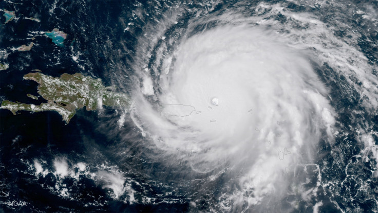
A new wave to hit the east of the Lesser Antilles is called Tropical Depression Five, and could develop into a hurricane by the middle of the week. The storm has the potential to move very close to Puerto Rico.
The Atlantic hurricane season typically runs from June 1 to Nov. 30, potentially causing a high death toll and catastrophic damage to infrastructure.
In September 2017, Hurricane Maria hit Puerto Rico and was the deadliest Atlantic hurricane since 1998, killing over 3,000 people. Also in 2017, Hurricane Harvey hit Texas and Louisiana, killing over 100 people and causing roughly $125 billion in damages.
In 2005, Hurricane Katrina hit New Orleans and killed 1,836 people, the deadliest hurricane in the U.S. since 1928.
© Copyright IBTimes 2025. All rights reserved.
- MOST POPULAR IN National


