

Snow In California: Winter Storm Warning Issued For Sierra Nevada, Other Regions

A series of Pacific storms are bringing several feet of snow to mountain areas in California – a weather phenomenon expected to continue till the end of the week.
“The upper-level pattern will favor a trough of low pressure moving across the western U.S. into the Plains while a ridge of high pressure is forecast to persist over the eastern U.S. This will allow unsettled weather and chilly temperatures to continue for much of the West and into the northern Plains," the National Weather Service’s (NWS) Storm Prediction Center stated.
“The current system that is bringing widespread precipitation for the West Coast and heavy snow along the Sierra Nevada will edge its way eastward into the Great Plains by the weekend. Low-elevation rain and mountain snow will progress gradually eastward across the Great Basin and into the central and northern Rockies on Friday,” it added.
A multi-day threat of #severe thunderstorms will commence in the Plains on Friday and continue into the weekend and next week: https://t.co/XJ4r6wu6wN pic.twitter.com/e1LMAahjfz
— The Weather Channel (@weatherchannel) May 15, 2019
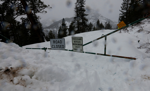
A winter storm warning was issued Thursday for the Sierra Nevada, a mountain range located between the Central Valley of California and the Great Basin; the area surrounding the North Fork Kings River; and the Sequoia National Park. The warning was to remain in effect till 6 a.m. PDT (9 a.m. EDT), Friday.
“Heavy snow above 5000 feet. Additional snow accumulations of up to several inches tonight [Thursday]. Thunderstorms are possible with heavy snowfall and gusty winds. Storm total snow amounts up to two feet. Winds gusting as high as 40 mph,” the warning said, adding, “Travel could be very difficult. The hazardous conditions could impact the morning or evening commute… If you must travel, keep an extra flashlight, food and water in your vehicle in case of an emergency.”
According to AccuWeather, the severe winter storm will bring with it heavy rain, thunderstorms, wind and mountain snow.
"This storm will bring unusually heavy rainfall and a flooding and mudslide threat to parts of California in what is normally a dry month," AccuWeather senior meteorologist Jack Boston said.
Widespread rain & mountain snow return to #NorCal this week. Here's a look at how much precipitation is expected through early Friday. Rain begins late tonight, while most mountain locations won't see snowfall until early Thursday. #CAwx pic.twitter.com/ZbBuCPgvEY
— NWS Sacramento (@NWSSacramento) May 15, 2019
However, California Office of Emergency Services Director Mark Ghilarducci said the upcoming storms were not expected to create widespread flooding in the state, as some of the snow deposited over the last few days had already melted, Fox News reported.
Yosemite National Park spokesman Scott Gediman said although the tourist spot will remain open, some of its main attractions such as the 16-mile Glacier Point Road, which offered sweeping views of Yosemite Valley and Half Dome, closed at 6 p.m. PDT Wednesday, ahead of a series of storms expected to dump at least a foot of snow on the highest peaks and will remain inaccessible till the severe weather passes.
As the storm system reaches the Central Plains and Ohio Valley on Friday, “Very large hail, damaging winds, tornadoes, and heavy rain can be expected," the NWS said, adding, "Severe weather threats will continue through the weekend and into next week."
© Copyright IBTimes 2025. All rights reserved.
- MOST POPULAR IN National


