

Winter Storm Wesley: Where And When Will The Blizzard Conditions Hit The Midwest?
Spring may have finally arrived, but the latest reports from the National Weather Service show that the Midwest won’t be experiencing it just yet. Another "bomb cyclone" is on the horizon with Winter Storm Wesley targeting the Rockies and parts of the Great Plains.
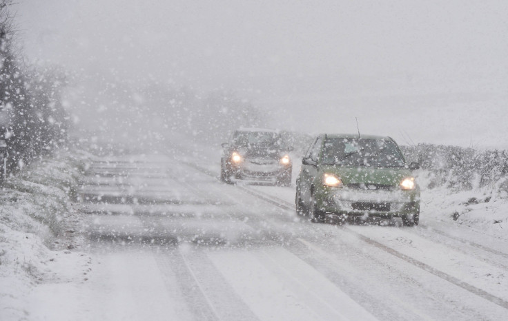
The latest forecast calls for a winter storm that could produce "heavy snow" buildup and blizzard conditions across the Plains and Midwest starting Tuesday evening. The forecast also warns that the storm could possibly last until Thursday.
The current winter storm warnings are being sent out to 10 million people across the regions under greatest threat from the blizzard. However, over 26 million people are also receiving wind warnings.
The states under the greatest threat from the winds are Wyoming, Nebraska, South Dakota, and Colorado. Meanwhile, the winter storm warnings have been largely centered on Nebraska, Minnesota and South Dakota. Parts of South Dakota could see 30 inches of snow.
The snowfall is expected to reach around 8-inches for most of the general area in the storm, but the NWS did warn that some isolated areas could experience up to 18 inches or more of snowfall before the end of the storm. Given the wide area covered by the storm, the NWS hasn’t been able to point to areas that would be affected the worst.
The winter storm warnings also stand in sharp contrast to Monday temperatures, with parts of the Midwest getting above 70 degrees. In Denver, the temperatures reached 80 degrees on Tuesday, with the forecast for 50 degrees on Wednesday and 37 degrees on Thursday.
"All of these weather elements mean one thing, a very impactful event," said the Minneapolis branch of the NWS.
The office also warned that "this would include widespread travel impacts, and the anticipating of more river flooding once this all melts in the next week."
The storm's effects could linger for days, with the potential for more flooding. Floods in March killed at least three people and caused over $3 billion in damage.
Winter Storm #Wesley is a beast! Blizzard conditions...icing...heavy snow...and severe, it has it all! If you need to travel, TODAY is the day because it'll start impacting the plains tomorrow & Thursday. We've got the details from noon - 4pm CT (1-5pm ET) today! pic.twitter.com/InCsjXOJLT
— Liana Brackett (@LianaBrackett) April 9, 2019
© Copyright IBTimes 2025. All rights reserved.
- MOST POPULAR IN National


