

Extreme Weather 2019: Tropical Disturbance In Caribbean Gains Strength, Could Become Tropical Storm Humberto
The tropical disturbance in the Caribbean could become Tropical Storm Humberto sooner than originally forecasted.
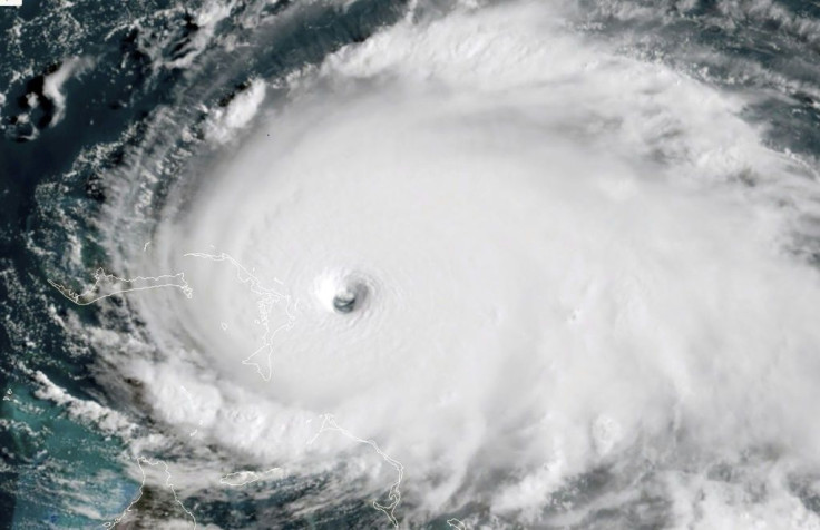
In the wake of Hurricane Dorian ravaging the Caribbean, the National Hurricane Center had been tracking multiple disturbances detected across the Atlantic Ocean. One of those was detected near the Bahamas, forecasted to be moving towards central Florida. The disturbance has continued moving westward towards Florida and the Gulf of Mexico and, with that, is now more likely to become a cyclone by Friday.
The NHC originally forecasted that the storm front had a 30% chance of forming into a cyclone over five days on Tuesday. It now has a 40% chance of forming into a cyclone by Friday and a 60% chance of forming by Monday.
“A large area of showers and thunderstorms was located along a sharp surface trough from near eastern Cuba through the southeastern Bahamas into the southwestern Atlantic,” the NHC reports.
The Bahamas is the first expected to get hit with this new storm front as it moves west. It comes at a bad time for the island chain, which is still recovering after being ravaged by Hurricane Dorian last week. Florida is also expected to get hit with heavy rain and winds, with some areas of the front reported to have tropical storm strength winds.
“Much of the Florida Peninsula will be on the Eastern side of the system,” said meteorologist Jayme King of WOFL, a Fox affiliate in Orlando. “This will provide the area with increasing breezes and periods of heavy tropical rainfall Friday-Sunday.”
© Copyright IBTimes 2026. All rights reserved.
- MOST READ


