

'Historic' Flooding On The Way As Hurricane Sally Crawls Toward Gulf Coast
KEY POINTS
- Hurricane Sally continued its slow march toward the Gulf Coast
- Rainfall for some areas is forecast to reach as much as 30 inches and cause 'historic' flooding
- Tornado watches are in effect for areas between the Florida Panhandle and southern Mississippi
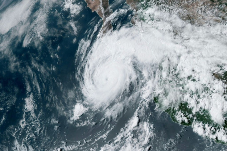
The National Hurricane Center warned Tuesday large parts of the Gulf Coast could be in for “historic” flooding from Hurricane Sally as it moves toward land.
“Historic life-threatening flash flooding is likely through Wednesday along and just inland of the coast from the western Florida Panhandle to southern Mississippi,” the NHC said in its forecast. “Widespread moderate to major river flooding is forecast along and just inland of the central Gulf Coast. Significant flash and urban flooding, as well as widespread minor to moderate river flooding, are likely across inland portions of Mississippi, Alabama, northern Georgia, and the western Carolinas through the week.”
Between 10 inches and 30 inches of rainfall was forecast for the area between the Florida Panhandle and southern Mississippi. Sally appeared to settle over this area on Monday and was only 110 miles south of Biloxi, Mississippi, by Tuesday.
Heavy rainfall is forecast further inland, as well, with most of the surrounding region expecting 4- to 12 inches.
One of the biggest reasons for the warnings is the slow speed at which Hurricane Sally has been traveling through the Gulf of Mexico. As of 1 p.m. Tuesday, it was moving northwest at just 2 mph. The slow progress means Sally will hammer coastal communities for longer periods of time, playing into the torrential rainfall already causing flash floods in same areas along the Gulf Coast.
Tornado watches are in effect for the Florida Panhandle through southern Mississippi and southern Alabama as winds average 85 mph.
© Copyright IBTimes 2025. All rights reserved.
- MOST POPULAR IN National


