

Hurricane Humberto Update: Category one Storm Strengthens Further
Hurricane Humberto has strengthened even further as it continues to move northeast on Monday morning, with sustained winds of 85 mph, the National Hurricane Center said.
On Sunday night Humberto had strengthened to a category 1 hurricane with sustained winds of 75 mph, according to NHC. It was 785 miles west of Bermuda and was continuing to move east, further away from the land into the Atlantic Ocean at 3 mph.
On Monday morning, Humberto grew stronger and gained more speed in its journey northeast as forecasted earlier. According to NHC’s 5:00 am update, it was now located 760 miles off west Bermuda moving northeast at 5 mph.
Hurricane #Humberto Advisory 15: Humberto Continues to Strengthen. https://t.co/VqHn0u1vgc
— National Hurricane Center (@NHC_Atlantic) September 16, 2019
Tropical Storm #Humberto is strengthening and is forecast to turn east-northeastward, away from the United States. However, there is a significant threat of rip currents along parts of the southeastern U.S. coast and NW Bahamas. Full advisory: https://t.co/tW4KeFW0gB pic.twitter.com/XQXwrtngLw
— National Hurricane Center (@NHC_Atlantic) September 15, 2019
Maximum sustained winds went up from 75 mph to 85 mph with the possibility of higher gusts. The hurricane is forecast to strengthen even more in the next couple of days. The center of the hurricane is expected to reach Bermuda, late Wednesday or Wednesday night, the update said.
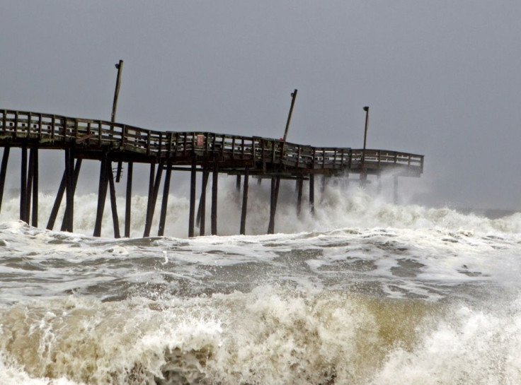
Surf warnings have been issued in the Bahamas and the southern coast of the U.S. Bermuda will experience periods of heavy rains beginning late Wednesday or Thursday.
“Swells generated by Humberto will affect the northwestern Bahamas and the southeastern coast of the United States from east-central Florida to North Carolina during the next few days. These swells could cause life-threatening surf and rip current conditions,” NHC said in its statement.
No coastal watches or warnings are currently in effect.
The Bahamas escaped the brunt of Humberto as the hurricane passed by the island on Saturday with sustained winds of 70mph. However, 1 to 2 inches of rainfall is predicted in the Bahamas due to the outer rain bands associated with the category 1 hurricane.
The news of Humberto approaching the Bahamas was a great cause of concern, as rescue operations in the islands which are currently recovering from the aftermath of category 5 hurricane Dorian would have taken a hit.
Though the Bahamas got some rain, rescue teams carried out the activity of searching for almost 1500 people who are reportedly missing.
"They were spared the heaviest rain and the strongest winds, which were centered north and east of the storm," CNN meteorologist Derek Van Dam said.
As the hurricane season continues, forecasters are actively monitoring two more hurricanes, one in the Gulf of Mexico and other in the Atlantic Ocean. The disturbance in the Atlantic Ocean has a 50% chance of forming a cyclone in next 48hrs.
© Copyright IBTimes 2025. All rights reserved.
- MOST POPULAR IN National


