

Extreme Weather 2020: Isaias Upgraded To Hurricane, Forecast To Travel Along US East Coast
KEY POINTS
- Hurricane and flood warnings have been issued for the northern Caribbean and southern Florida as Isaias moves northwest toward the U.S.
- Isaias projected path has it beginning to shift northeast and traveling along the U.S. East Coast through next week
- Isaias is projected to peak Saturday with winds reaching 100 mph as it hits the Bahamas and southern Florida
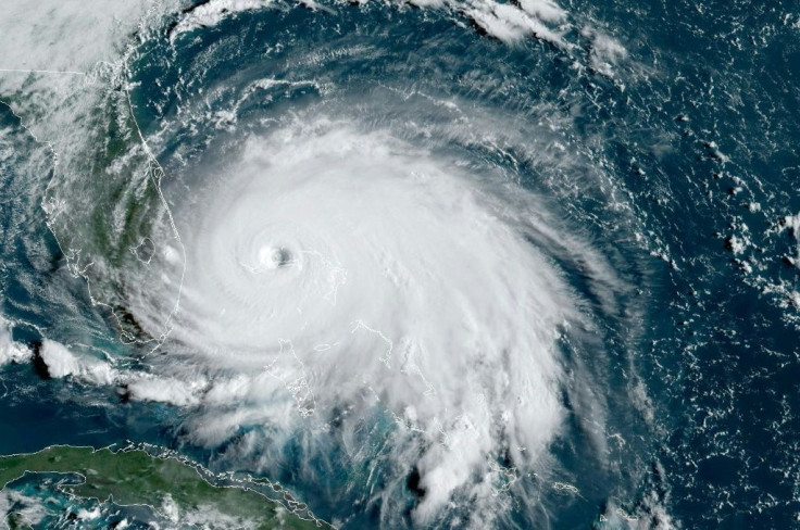
Isaias was upgraded from a tropical storm to a hurricane overnight and is forecast to continue strengthening as it moves across the Bahamas on its way to Florida Friday.
As of 8 a.m. Friday, Hurricane Isaias had sustained winds of 80 mph with the heart of the storm sitting off the northern coast of eastern Cuba. It has begun to turn north and was moving northwest at 17 mph.
“Isaias will produce heavy rains and potentially life-threatening flash flooding and mudslides across the Dominican Republic, northern Haiti, Turks and Caicos, and the Bahamas,” the National Hurricane Center said.
“Heavy rains associated with Isaias may begin to affect South and east-Central Florida beginning late Friday night, and the eastern Carolinas by early next week, potentially resulting in isolated flash and urban flooding, especially in low-lying and poorly drained areas. Isolated minor river flooding is possible in the Carolinas early next week.”
Southern Florida is forecast to be hit by the storm in earnest around 8 a.m. Saturday when Isaias makes direct landfall over the Bahamas. The storm is expected to peak around the same time, with the Bahamas and coastal communities in Florida warned winds could reach upward of 100 mph.
Isaias projected path has the storm skirting the U.S. East Coast over the next week, weakening as it begins to move northeast. It is expected to maintain tropical storm strength as far north as Delaware before beginning to break up into more widely scattered storms by the time it reaches southern New York.
Some forecasts said the storm could weaken before it hits Florida as a result of possible wind shear along the Bahamas. However, the Weather Channel said warm waters in the area may be enough to allow Isaias to maintain its strength and grow heading into the weekend.
© Copyright IBTimes 2026. All rights reserved.
- MOST READ


