

Hail Storm In North Texas: Photos, Videos Of Huge Hailstones, Cars Damaged

Different parts of north Texas was pelted with hail Sunday evening as a number of thunderstorms moved through the region.
A severe weather warning was issued by National Weather Service Fort Worth, Texas, for places like Fort Worth, Arlington, Irving, Grand Prairie, Euless, Bedford, Grapevine, Haltom City, Keller, Coppell, Hurst, Southlake, Watauga, Colleyville, Saginaw, Richland Hills, Eagle Mountain, North Richland Hills, Roanoke and Blue Mound. The warning lasted until 10:30 p.m. CDT (11:30 p.m. EDT).
A hazardous weather outlook issued Sunday afternoon stated, “Thunderstorms are expected to develop late this afternoon and into the evening hours ahead of an advancing cold front. Areas that are both east of I-35 and north of I-20 are the most likely to be impacted by the storms this evening. Some of the storms may be severe with large hail and damaging winds the primary hazards. Although there may initially be discrete supercells near the boundary, veered surface flow and elevated cloud bases will limit the tornado potential.”
“A line of thunderstorms may continue to impact portions of Central and East Texas during the Monday morning commute before exiting the region. Strong gusty winds and heavy rain will be the primary hazards with these storms,” the warning continued, adding that there were chances of thunderstorms later in the week, on Friday and Saturday.
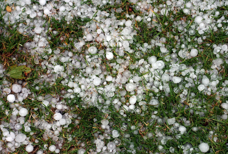
Residents of the area took to Twitter to share photos and videos of hail-covered homes and streets, as well as cars damaged by the hail.
@NBCDFWWeather @NBCDFW @GrantJNBC5 Got caught on the 121 in Mckinney during the #hail storm today. pic.twitter.com/JT8HN3vyHm
— Xtreme Heights (@xheightsprod) March 25, 2019
Hail in McKinney 😐 pic.twitter.com/a75c3xVE9G
— Gabe. (@gibgabe) March 25, 2019
Hail Storm in #Frisco #Texas pic.twitter.com/pzZGCJ9i5K
— Rabiah Foss (@RabiahFoss) March 25, 2019
Hey @Pluckers. My car is almost 20000% getting totaled out bc I wanted some spicy lemon pepper wings and it happened to hail while we were there but boy was it worth it 😭😩 pic.twitter.com/WeAEyhX6s2
— Danté Dio | dRob24 (@DRob_24) March 25, 2019
@RickMitchellWX - Hail punches holes through my car. pic.twitter.com/GhuAPgZHv5
— kevin zimmerman (@atfekz) March 25, 2019
The storm system that was responsible for generating severe weather over the southern Plains on Friday, and massive hail in central Oklahoma on Saturday, brought the thunderstorm to Texas. There were reports of a confirmed tornado in Cadet, Missouri, around the same time that Texas was getting pelted with golf ball-sized hail.
"The storm that spawned the tornado caused a number of reports of golf-ball sized and larger hail. The largest reported was 2.5 inches. That’s nearly baseball-sized," AccuWeather Meteorologist Frank Strait said.
"Farther to the southwest, other storms in western Arkansas, eastern Oklahoma and North Texas have produced wind and hail damage,” he added. "The worst so far has been in Collin County, Texas, in and just south and west of McKinney. Baseball-sized hail was reported; it may have been even larger than that in a few places."
Some of the adverse effects of thunderstorms included reduced visibility, ponding of water on the roadways and flooding of the river banks. There was also damage to several vehicles due to the hail. People were advised not to go outside as long as the severe weather lasted and to stay away from windows while taking shelter.
According to Texas Power Outage map, around 500 people in the state were without electricity. There were no casualties reported.
© Copyright IBTimes 2025. All rights reserved.
- MOST POPULAR IN National


