

Indonesia Rattled by 6.3 Magnitude Earthquake; Residents Fear Tsunami
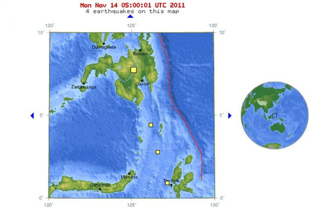
A 6.3-magnitude earthquake hit off the coast of Indonesia, in the Molucca Sea around at 1:05 p.m. local time. It was centered 42 miles southwest of the town of Labuha on the island of Pulau Bacan.
The earthquake caused a panic, sending residents fleeing for higher ground. However, officials said that there's no tsunami threat.
The last major earthquake to hit Indonesia happened in September. A 6.6 magnitude earthquake occurred on the country's western island, its epicenter was about 60 miles southwest of the capital of Medan.
Two people died as a result of the quake. A 12-year-old boy who was lying in bed was crushed by falling debris, while a man died of a heart attack as he fled his home.
Indonesia sits on a number of fault lines, making it a highly active seismic zone. On average, there have been 4.2 major earthquakes per year in Indonesia since 2000. In April, the country was hit by a 6.7 magnitude quake. There were no reported fatalities. According to the U.S. Geological Survey, the western coast of Sumatra is one of Indonesia's most seismically hazardous areas.
Many Indonesians still remember the December 2004 quake and ensuing tsunami that killed a quarter million people, most of them in the Aceh province on the northern tip of Sumatra.
On Monday, up to 45,000 people could have felt the shaking, according to the U.S. Geological Survey. No casualties have been reported.
© Copyright IBTimes 2025. All rights reserved.
- MOST POPULAR IN Society


