

Strong Earthquake Leaves at Least 16 Dead in India, Nepal
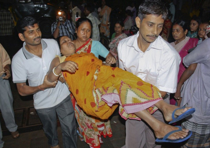
A magnitude 6.9 earthquake killed at least 16 people and injured dozens more on Sunday. The quake struck at 6:10 p.m. local time near the India-Nepal border, centered about 40 miles from the city of Gangtok, in Sikkim state.
Violent shaking collapsed a number of buildings in Kathmandu, the capital of Nepal, including the British embassy. Two children were killed when a wall outside the embassy broke, and at least three people died when another building fell nearby.
In Sakkim, the quake triggered large mudslides, isolating many people in remote areas and trapping at least one person inside a vehicle. State officials in West Bengal and Bihar also reported a total of six additional causalities.
The Indo-Tibetan Border Police sent out officers to search for people under piles of debris. The Indian air force also sent five planes to help rescue workers.
We have sounded a high alert. Police are on the streets in Gangtok and other major towns, Saakim state police Chief Jasbir Singh told The Associated Press.
Downed power lines in Darjeeling and Kalimpong have left the cities in darkness, and the quake disrupted land line telephone service in Sakki.
The earthquake was followed by two aftershocks measuring 6.1 and 5.3 magnitude on the Richter scale, according to reports. The tremors could be felt as far away as Delhi, about 900 miles to the west.
Delhi, the capital of India, itself just suffered a minor earthquake on Sept. 7, when a 4.2 magnitude quake hit the city just hours after a bomb blast killed 11 and injured dozens more outside the Delhi High Court.
Gangtok is considered to be in Zone 4 of the Earthquake Hazard Map of India, and it is therefore designated as being in the High Damage Risk Zone. The city is also nestled between two Zone 5 (highest risk) areas to the east and west.
Delhi is also in Zone 4, but there hasn't been a major earthquake in the city's recent history.
Earthquakes in India aren't rare, but a 6.9 magnitude quake is significant. The last major quake on the India-Nepal border occurred in August 1988, when magnitude 6.8 earthquake killed 721 people, injured more than 6,000 and damaged 64,470 buildings in eastern Nepal, including the Kathmandu Valley, according to the U.S. Geological Survey.
India sits on the Indian Plate, a tectonic plate that has been colliding with the Eurasia Plate for about 50 million years. The Indian Plate is slowly being wedged under Eurasia, pushing up the northern plate, causing it to lift. The tectonic movement created the Himalayan Mountain range, which straddles the collision point among India, Nepal, Tibet and China.
Because of the plates' movement, the Himalayas are growing taller every year.
© Copyright IBTimes 2025. All rights reserved.
- MOST POPULAR IN Society


