Hurricane Irene 2011 Expect to Hit Carolinas, Max Speed 115 mph [MAPS]
Hurricane Irene in 2011 is looking to be a fierce one.
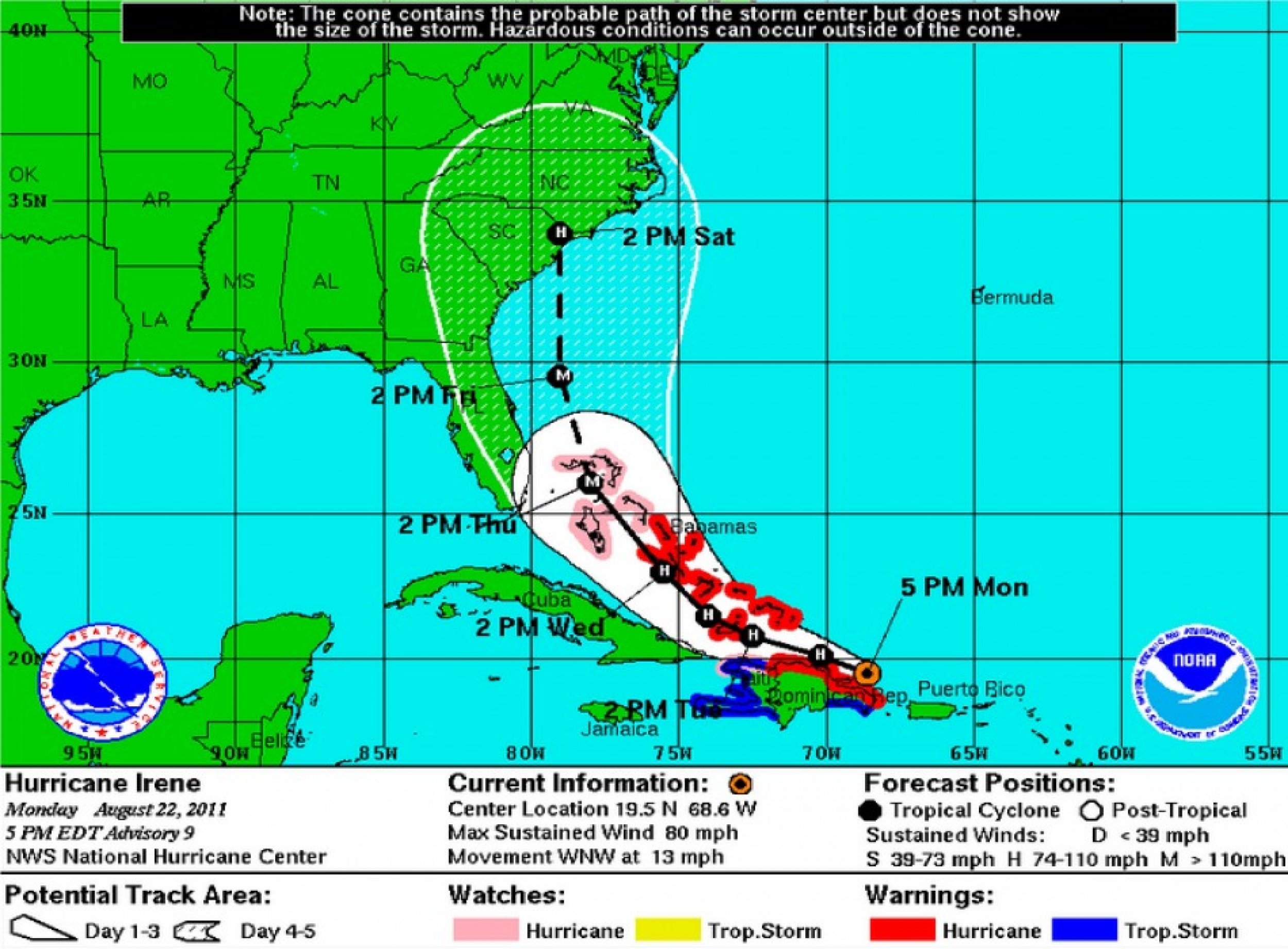
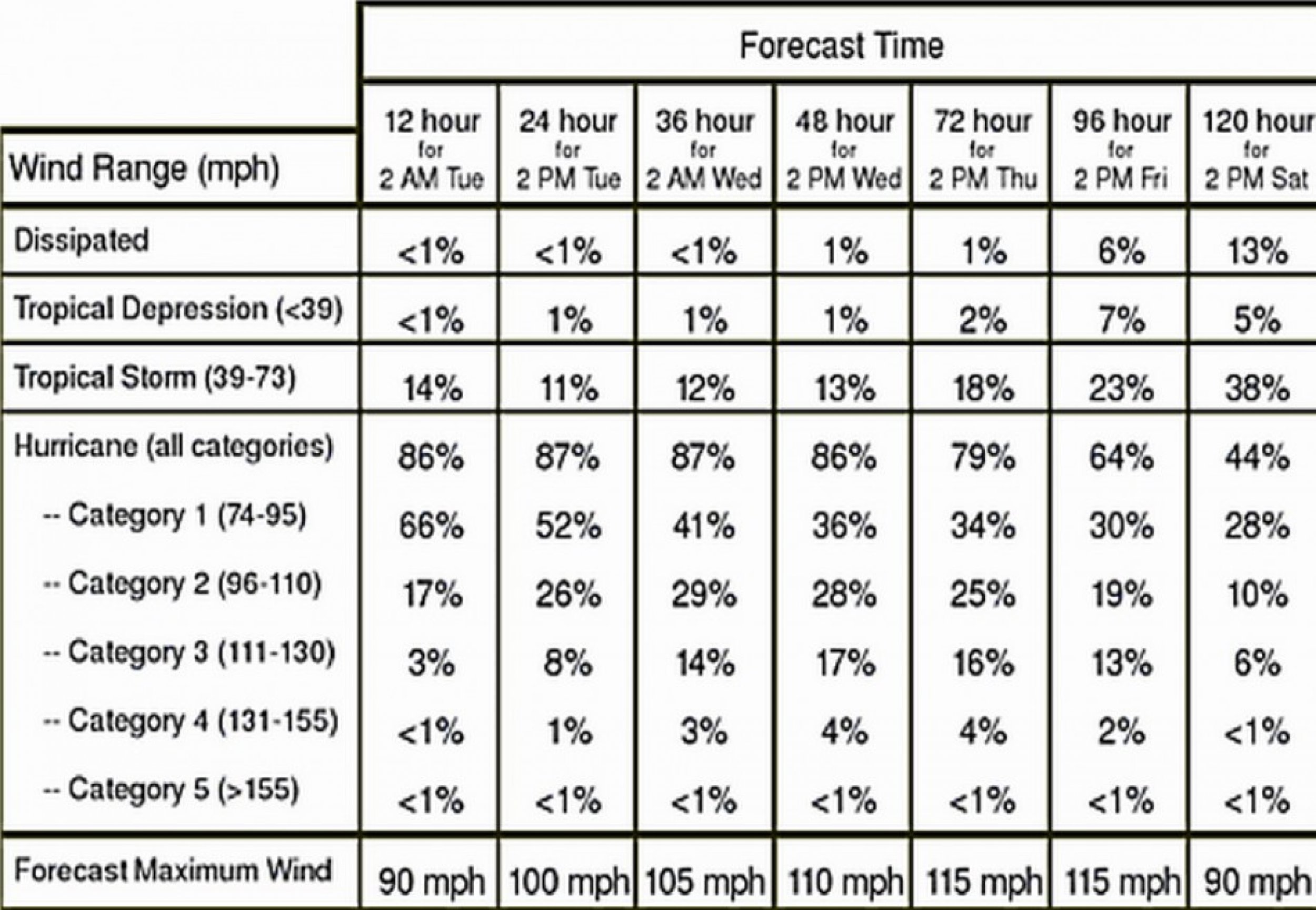
The National Oceanic and Atmospheric Administration (NOAA) expects its maximum wind speed to be 115 mph, which is expected to occur on Thursday and Friday afternoon.
Hurricane Irene made its way through Puerto Rico and is now eyeing the U.S. East Coast. On Monday afternoon, it passed the southern tip of the Dominican Republic.
As of Monday 7:50 p.m. EST, it strengthened to a Category 2 hurricane, with maximum winds reaching 100 mph.
In the next few days, the storm is expected to graze Cuba (Wednesday), hit Florida (Thursday) and Georgia (Friday), engulf North Carolina and South Carolina (Saturday), and reach as far up as Virginia, according to the NOAA map below.
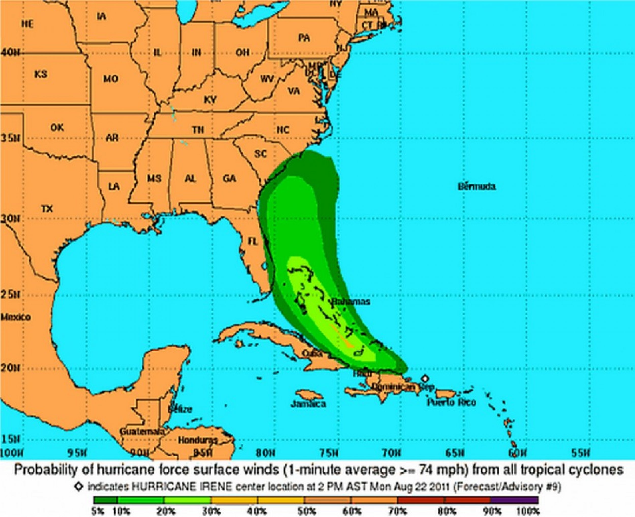
However, the NOAA only sees the possibility of hurricane level winds, defined as those exceeding 74 mph, to hit limited areas along the east coast of Florida, Georgia, South Carolina, and North Carolina, according to the second NOAA map below.


© Copyright IBTimes 2025. All rights reserved.


