

Hurricane Irene Heads for Bahamas, U.S. East Coast
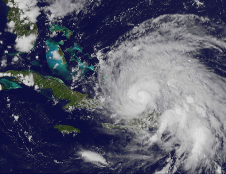
Hurricane Irene has regained its strength and is expected to strike southeastern and central Bahamas Wednesday, according to the U.S. National Hurricane Center.
A hurricane warning is in effect for Turks and Caicos Islands and the southeast, central and northwestern Bahamas. A tropical storm warning has been issued for the north coast of Haiti from Le Mole St. Nicholas eastward to the Dominican border.
At present, the center of Irene was located by an Air Force hurricane hunter aircraft near latitude 21.3 north, longitude 72.6 west. The eye of the hurricane has been wobbling over the past few hours, but Irene is moving generally toward the west-northwest near 9 mph.
A gradual turn toward the northwest is expected Wednesday. On the forecast track, the core of Irene will move across the southeastern and central Bahamas Wednesday and over the northwestern Bahamas on Thursday.
Maximum sustained winds have increased to near 100 mph with higher gusts and Irene has again become a Category 2 hurricane on the Saffir-Simpson hurricane wind scale.
Strengthening is forecast and Irene could become a major hurricane within the next day or so, NHC said.
Wind speeds have classified Irene for a Category 2 determination, but that level could rise to a Category 3 soon.
Tropical cyclones of Category 3 and higher are described as major hurricanes in the Atlantic or Eastern Pacific basins. These storms can cause some structural damage to small residences and utility buildings, particularly those of wood frame or manufactured materials with minor curtainwall failures. Recent examples of Category 3 storms include Isidore in 2002, Jeanne in 2004, Lane in 2006 and Karl in 2010.
NHC said wind hurricane conditions are occurring over portions of the Turks and Caicos Islands and are beginning to spread over the southeastern Bahamas. Tropical storm conditions are expected to begin over the central Bahamas on Wednesday with hurricane conditions expected by night.
Tropical storm conditions are expected in the northwestern Bahamas later Wednesday night with hurricane conditions expected on Thursday.
The agency said the hurricane could raise water levels by as much as 7 to 11 feet above normal tide levels over the central and northwestern Bahamas and by as much as 5 to 8 feet above normal tide levels over the southeastern Bahamas and the Turks and Caicos.
A storm surge will raise water levels by as much as 2 to 4 feet above normal tide levels along the north coast of Haiti, the agency added.
Irene, the first hurricane of the 2011 Atlantic season, is expected to approach the coast of the Carolinas on Saturday morning. New England could see torrential rains, high winds and flooding from Irene as its soil is already saturated from summer storms.
Irene caused havoc in Puerto Rico on Monday, leading to the death of a woman, authorities said. The hurricane caused extensive damage to roads, toppled multiple trees and utility poles, leaving more than one million residences without power. President Barack Obama has declared a state of emergency for the territory.
© Copyright IBTimes 2025. All rights reserved.
- MOST POPULAR IN Society


